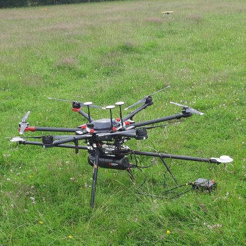
A research team has used drone-mounted and ground-based instruments to survey the 3D structure of parts of the forest in great detail.
The team from the University of Cambridge, Routescene and the University of Bristol, with assistance from Forest Research, has recently begun building a 3D digital model of the structure of two long-term monitored forest plots in the Straits Inclosure in Alice Holt: the ECN and ICP Level 2 plots. To do this they used ground-based laser scanning and flew a drone equipped with a Lidar (light detection and ranging) instrument over the forest.
The team are using these data to test the ability of these remote sensing technologies to extract information about tree stem and crown dimensions. They will test the relationship between the long-term records of individual stem demography and dynamics and the shape of the trees and crowns, to try to understand how remote sensing data can better inform predictive forest models. The researchers will also use these remote sensing data to understand how the light environment and competition for light drives morphological plasticity, stem arrangement and understorey structure.
This work is part of Dr Emily Lines' UKRI Future Leaders Fellowship. Dr Lines is a Lecturer in Physical Geography at the University of Cambridge, a UKRI Future Leaders Fellow, and a Turing Fellow at the Alan Turing Institute (the national institute for data science and artificial intelligence).
