Terrestrial ● Lakes ● Rivers ● Research access ● Co-location ● Fixed-point photos
Sites
In this section...
ECN: a network of sites
ECN is a network of intensively studied sites across the United Kingdom, at which repeated measurements of physical, chemical and biological components of each ecosystem are repeatedly made.
We have been studying our earliest sites since the early 1990s.
We have been studying our earliest sites since the early 1990s.
ECN terrestrial sites
There are 11 active terrestrial sites, ranging from upland to lowland and covering a wide range of habitats including semi-natural grassland, woodland, moorland, peatland and arable cropland. They form the main component of ECN. These sites are operated by a subset of ECN consortium partners. Each site has a dedicated and highly knowledgeable Site Manager whose duties include carrying out the ECN protocols and submitting the data to the ECN central database.
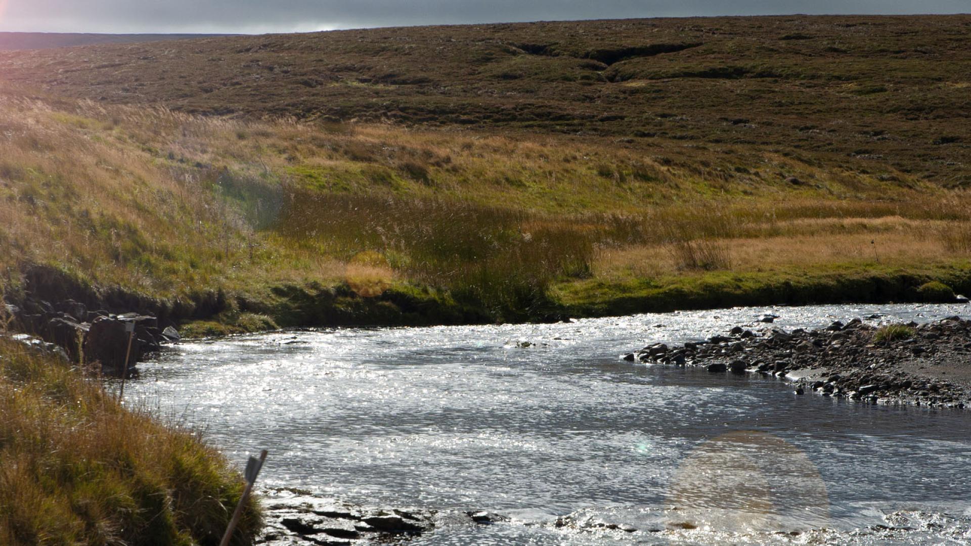
ECN freshwater sites
The freshwater component of ECN comprises both lakes and rivers/streams. Data from the majority of these sites are collected by the environment agencies in Scotland, Northern Ireland, England and Wales as part of their statutory duty to monitor water bodies under the Water Framework Directive. The remaining sites are operated by a range of ECN partners. Several of the sites are Upland Waters Monitoring Network sites. Until 2012, ECN received data from these freshwater sites. Whilst this is no longer the case, data are, to our knowledge, still routinely collected at these sites by the organisations indicated.
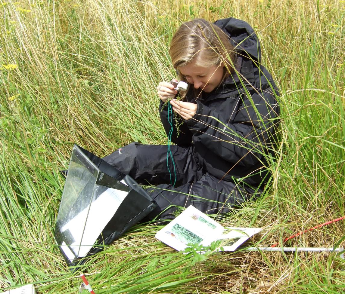
ECN sites: Great places for research & teaching
The wide range of environmental measurements, wealth of historical data and local knowledge of site managers mean that many ECN sites are excellent locations for field environmental research and teaching. An increasing number of scientists have discovered the benefits of locating their research at our sites. If you are also interested in conducting research at an ECN site, please contact us. From time-to-time there are opportunities for people outside the UK to visit selected ECN sites as part of EU-funded projects.
Are you interested in conducting research or field teaching at an ECN site?
Overview map
To learn more about sites in the ECN network, select a site from the lists on this website (terrestrial, lakes, rivers) or locate it on the map.
![]() To filter the displayed sites, open the side menu panel.
To filter the displayed sites, open the side menu panel.
![]() ECN Terrestrial
ECN Terrestrial
![]() ECN Freshwater
ECN Freshwater
Co-location
Co-location of monitoring operations is important for providing added value to datasets, and is also financially and operationally more efficient. Four of the ECN terrestrial sites are co-located with ECN stream sites, whilst many of ECN terrestrial sites are equipped with soil moisture monitoring arrays operated by the COSMOS-UK network and several lakes have automatic lake monitoring stations installed as part of the UKLEON project. Furthermore, four ECN sites host Long-Term Experiments (LTEs) supported by the Ecological Continuity Trust.
Learn more about how ECN sites contribute to monitoring by other networks.
Related networks and sites
You may be interested in these other long-term environmental observation networks and sites that have links to ECN:
- Upland Waters Monitoring Network (UWMN). The following ECN sites are also UWMN sites: Allt a'Mharcaidh, Trout Beck, Scoat Tarn, Lochnagar, Llyn Llagi, Old Lodge
- Long-Term Monitoring Network (LTMN), operated by Natural England and established as NE's component of the Environmental Change Biodiversity Network (ECBN) initiative
- Conwy Research Catchment and Plynlimon Research Catchments, both run by UKCEH
- Peatland Nitrogen Pollution Experiment operated by UKCEH
- Research Forests, including Alice Holt. Operated by Forest Research
- North Wyke Farm Platform. Operated by Rothamsted Research
- The UK Centre for Ecology & Hydrology's science infrastructure
- The UK Environmental Observation Framework, the coordinating body across the public sector for the UK's environmental observation community.