This section introduces weather fronts and explains the differences between warm fronts, cold fronts and occluded fronts. If you watch a TV weather forecast you will often hear fronts mentioned. They are a very important weather feature.
What is a front?
Day-to-day changes in the weather are caused by the influence of different air masses as they pass over the land. The front is the boundary where these different air masses meet. Fronts can either be Warm, Cold, or Occluded.
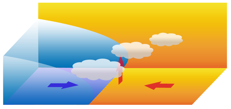
The picture below shows the formation of a front. There are parts of two air masses shown in the diagram, a colder one (blue) and a warmer one (orange). The cold air moves underneath the warm air. This happens because the warm air is lighter (less dense) than cold air, which is dense and heavy.

Clouds are formed when the warm air rises, cools and moisture condenses (changes from a vapour to a liquid). Fronts may be seen on a satellite weather photograph as thick bands of clouds.
Exercise
The Zoom.Earth website has up-to-date satellite images of the world. Viewing the satellite imagery, take a look at either the current image or an earlier image. Are any thick bands of clouds visible, that may indicate a weather front?