The weather we experience at the surface of the Earth is a product of patterns of air movement in the Earth's atmosphere.

The atmosphere is not static; instead, air is in constant motion, driven, for example, by the sun's energy warming land masses.

Warm air rises, cool air sinks. This means there are vertical flows of air. The air will have different temperatures and densities in different regions of the globe, and these 'air masses' behave differently. At the boundary of air masses, weather fronts may form.

This section covers air masses and weather fronts.


Stormy sky in Scotland. Photo: Andy Sier
A stormy sky on the west coast of Scotland. Photo: Andy Sier

Exercise

Before going further, let's start by taking a look at today's weather.

The weather where you are

First, observe the weather where you are. Step outside or put your head out of the window. What is the weather like? Consider the following:

  • Is it sunny or cloudy?
  • Is it raining, snowing or dry?
  • Is it still or windy?
  • Is it hot or cold?


Here are some aspects of weather to think further about:

  • Cloud cover. Can you work out roughly how much cloud cover there is?
  • Rain/snow: what terms can you use to describe the amount of rain or snow?
  • Temperature: is how warm or cold it feels on your skin a good way to determine air temperature? If not, why not?
  • Windiness: what terms are there to describe the strength of the wind?


The weather at an ECN site

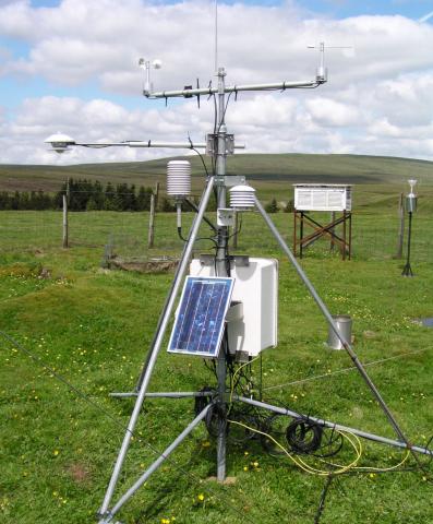
At ECN sites we record weather variables using accurate sensors on an Automatic Weather Station (AWS) like the one shown in the photo below. This is an AWS at Moor House, In the background you can also see a white box - a Stevenson Screen - which contains manually-read weather instruments.

Image
Automatic Weather Station

Let's look at some real-time weather data collected at ECN Rothamsted in Hertfordshire:


More about weather at ECN sites

You might find these news items on our website interesting:


* Source: Rothamsted Research Ltd