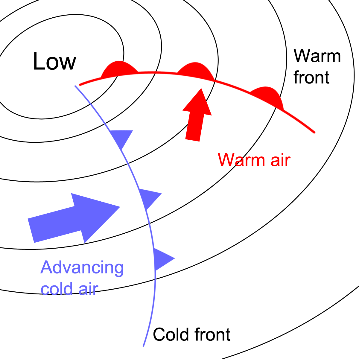
If you read the section on Fronts you will have learned that when areas of warm and cold air meet, the warm air rises up and over the colder air. When a fast moving area of cold air moves into a region of warmer air it forces its way under the warm air, which is pushed upwards. As it rises, air pressure falls.
This rising air can lead to a low pressure system or depression. Here is a reminder of the diagram showing warm rising over colder air. At the front, air pressure falls.

On weather charts and forecasts you will see fronts associated with a depression:
Viewed from above, the air within a depression circulates in an anti-clockwise direction in the Northern hemisphere (they circulate clockwise in the Southern hemisphere). This is the opposite of anticyclones. Here's a diagram of a low pressure system over the UK:
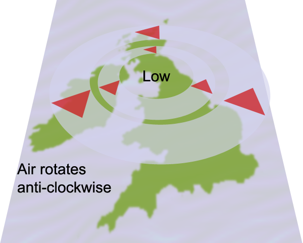
Low pressure systems or depressions bring the cloud, rain and wind that we usually associate with British weather.